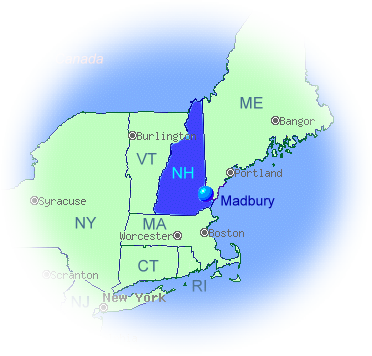
MADBURY is situated on the southeastern section
of New Hampshire, comprising about 7,600 acres. It
is bounded on its northeast border by the City of
Dover; on the southern line by Durham and Lee, and
on the west by Barrington. The Barrington line is
slightly less than three miles long; and from the
corners of this line, the Madbury town lines
converge to the southeast until they reach
tidewater -- a distance of about seven miles to form
a wedge shaped triangle, whose base is at Barrington
and apex is at a point adjacent to the spot where the
Bellamy River enters Little Bay. This location has
been variously known as Cedar Point, Tickle Point,
and Hill's Neck.
The Bellamy River is the only one of any size in
Madbury and, until the Bellamy dam was built,
Barbadoes Pond was the town's largest body of
water. The Bellamy Reservoir provides 50-60% of
the City of Portsmouth's water supply.
Although it has always been in the center of an
industrial area, Madbury itself has always remained
rural in character. There was never a village or
hamlet in the town. For years lumbering and
agriculture were its mainstays. However, quite
recently it changed to what is primarily a residential
town, and furnishes homes for many whose income
is derived from adjacent areas.
Madbury, New Hampshire
The New Hampshire Employment Security's Economic and Labor Market Information Bureau maintains
Community Profiles on towns and cities in New Hampshire.
You may visit Madbury's Community Profile here: https://www2.nhes.nh.gov/GraniteStats/SessionServlet?
Adapted from: Madbury Its People and Places by Eloi A. Adams, 1968, for the bicentennial.
Click here to download a scanned copy of the 1968 book: Madbury Its People and Places
Click here to download a scanned copy of the 1968 book: Madbury Its People and Places

Copyright © 2002-2024 Town of Madbury, NH. All rights reserved.


- Groups & Links

Madbury Fire Department

Madbury Police Department

Madbury Public Library
Madbury Planning Board (their own site)
Local Groups
ReadyRides - free medical rides